Well markers
click to enlarge
click to enlarge
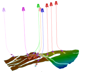
A well marker is used to record the depth in a wellbore at which the wellbore intersects an identified horizon (conformable, unconformable or intrusive) or fault. Marker depths are identified during well log analysis and correlation. Markers are an input to subsequent modeling workflows such as Stratigraphy, 3D Structure and 3D Grid.
Custom format (*.)
Using this file type you can import markers from custom column-formatted files. During import you specify which data item is represented in which column.
JOA Marker ASCII Files (*markerset.ascii)
This is a proprietary ASCII file format. For format details, see ASCII file format marker set.
JOA Marker Files (*.joamarkerset; *.xml)
Landmark OpenWorks™ Marker files (*.wlx, *.owx, *.dat)
Well Data Export
Project : ORT47_ONSHRE
Cartographic System : NIGERIA MINNA (DMA) TM WBELT CM 04.5E
Depth Mode : MD
Depth Unit : Common feet
Distance Unit : meters
Format File : /vend/r03/dat/wlx/owxAll_2003+.wlx
Date : Thu Jan 19 07:53:20 2005
WELL BZ2012 API-01 AOF UNKNOWN
2WELL Nigeria Ltd Apih 01 47
3WELL 231694.480 225995.480 5.998384000 5.412041000 231694.440 225995.420 5.998382809 5.412040099 331694.480 220995.480 231694.440 225995.420
4WELL KB 42.000 13278.000 0.000
5WELL Nigeria UNKNOWN NIGERIA 0.000 0.000
6WELL ON Ap-01
7WELL Unknown Unknown Unknown Suspended - Oil
8WELL Apih UNKNOWN
CLTH LITH PAO 1928.500 2230.500 100.000 SANDSTONE
CLTH LITH PAO 2230.500 2231.500 100.000 SHALE CNL
CLTH LITH PAO 2231.500 2314.500 100.000 SANDSTONE
CLTH LITH PAO 2314.500 2317.500 100.000 SHALE CNL
CLTH LITH PAO 2317.500 2318.500 100.000 SANDSTONE
CLTH LITH PAO 2318.500 2320.500 100.000 SHALE CNL
Schlumberger Petrel™ well tops (*.*)
# Petrel Well Tops
VERSION 2
BEGIN HEADER
X
Y
Z
Confidence factor
Dip Angle
Dip Azimuth
Interpreter
MD
Missing
Type
Surface
Symbol
TST
TST Zone
TVT
TVT Zone
TWT Auto
TWT Picked
Used by Dep.Conv.
Used by Geo Mod
Well
Zone log
Edited by user
Locked to fault
END HEADER
2488968.74 3878227.77 -4992.43 -999 -999 -999 "kmeyer" 5265.78 -999 Horizon "Lower Thrust" Unknown -999 -999 -999 -999 -161.15 -999 TRUE TRUE "WELLA" -999 FALSE 0
2507921.91 3889639.99 -5131.79 -999 -999 -999 "kmeyer" 5232.85 -999 Horizon "Angostura 250" Unknown -999 -999 -999 -999 -98.11 -999 TRUE TRUE "WELLB" 11 FALSE 0
2507797.99 3890382.93 -4919.05 -999 -999 -999 "kmeyer" 5176.04 -999 Horizon "Angostura 250" Unknown -999