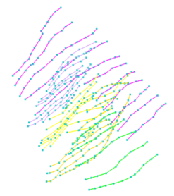
Polyline sets
click to enlarge
Polyline sets, which include fault sticks/picks and horizon picks, are lines and nodes that represent the manual or automatic interpretation of seismic data in the form of horizons and faults. They are used to create 2D grids or tri-meshes.
Schlumberger Charisma™ fault sticks (*.*)
INLINE- 11540 880 380417.29979 5946122.85909 2102.53253 F1 1
INLINE- 11540 871 380249.43474 5945960.27655 2382.63613 F1 1
INLINE- 11530 881 380257.76253 5946316.39501 2086.37931 F1 2
INLINE- 11530 871 380075.49729 5946139.86544 2409.09991 F1 2
INLINE- 11520 877 380018.40709 5946432.62452 2072.17365 F1 3
INLINE- 11520 865 379792.52985 5946213.85537 2435.44912 F1 3
Schlumberger CPS-3™ fault sticks (*.*)
FFASCI 0 1 "LINES" 0 1e+10
FFATTR 0 1
->1
2501761.128461 3891120.832095 -6171.863491
2503484.870183 3891111.691822 -4963.01844
Custom format (*.*)
Using this format you can import polylines from your custom column format. When importing this data you specify which data is represented in which column.
Earth Vision vertical fault format (*.vflt)
# Type: scattered data
# Version: 5
# Description: Exported from grid layer_2_top.2grd (carl, 11 Dec 1998)
# Format: free
# Field: 1 x
# Field: 2 y
# Field: 3 z
# Field: 4 column
# Field: 5 row
# Projection: Local Rectangular
# Units: unknown
# End:
# Information from grid:
# Grid_description: demo.seq
# Grid_size: 160 x 96
# Grid_X_range: 73000 to 80000
# Grid_Y_range: 286900 to 291100
# Vertical_faults: layer_2.vflt
# History: Imported from demo.evx (carl, 11 Dec 1998)
73000 286900 3930.36352539062 1 1
73044.0251572327 286900 3937.02685546875 2 1
73088.0503144654 286900 3943.89819335938 3 1
73132.0754716981 286900 3950.95825195312 4 1
73176.1006289308 286900 3958.01953125 5 1
73220.1257861635 286900 3964.919921875 6 1
73264.1509433962 286900 3971.45239257812 7 1
...
Paradigm GOCAD™ (*.pl, *.ts)
GOCAD PLine 1
HEADER {
name:JOA
*solid*color:1 1 0 0.5
}
GEOLOGICAL_TYPE fault
ILINE
VRTX 1 200 200 50
IESX fault sticks (*.*)
PROFILE P1 TYPE 2 3
unspecified m ms
1.10417300E+002 2.34612286E+003 1 101.53
1.21249435E+002 2.34596028E+003 1 201.64
IRAP Classic lines (*.*)
100.0001
200.0001
340.0001
520.0001
999.0 999.0 999.0
3189.995100 15623.997500 1625.000000
3189.995510 14312.831300 1940.000000
3189.995970 12822.868900 2145.000000
3189.996260 11928.891400 2325.000000
3189.996800 10200.534700 2625.000000
3189.997730 7220.610810 2935.000000
999.0 999.0 999.0
JOA polyline set (*.joapolylineset, *xml)
The JewelSuite Subsurface Modeling proprietary XML based file format for polyline sets.
Polyline set (ASCII) (*.polylineset.ascii)
A proprietary ASCII file format. For format details, see ASCII file format polyline set.